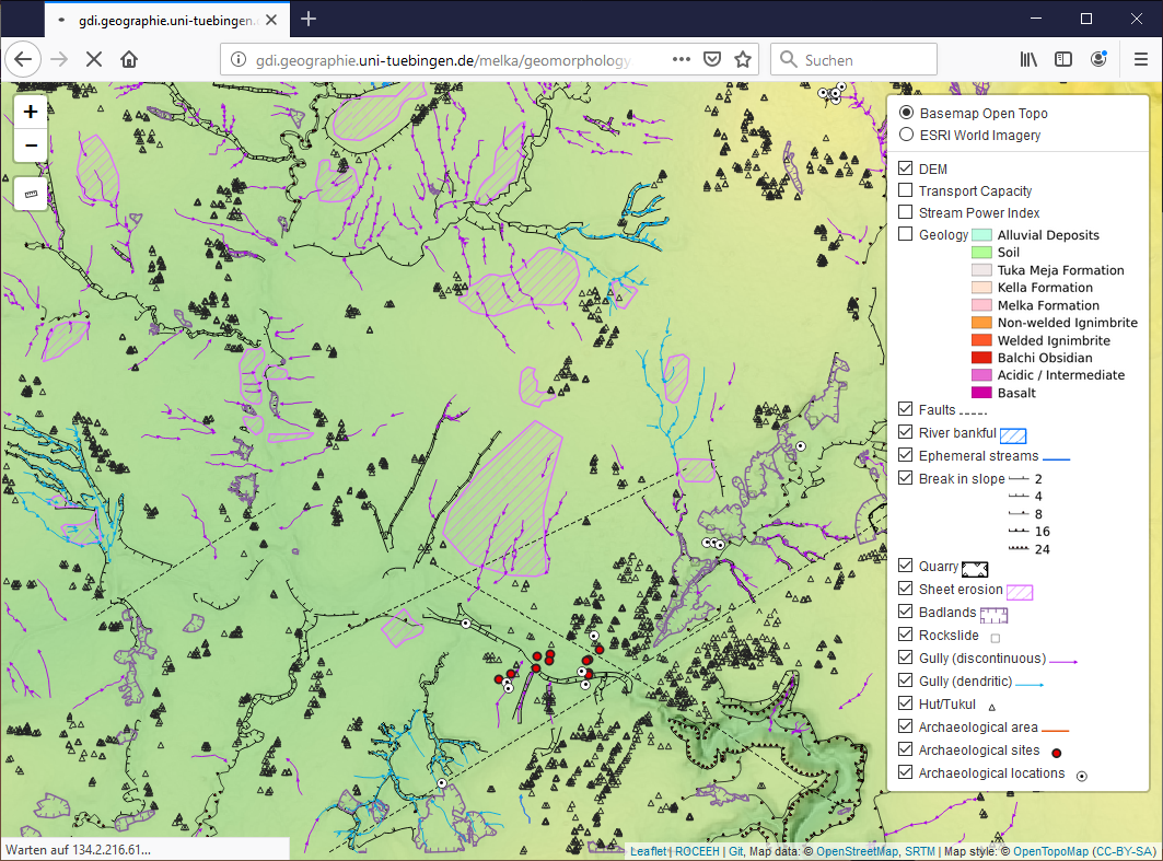
Geomorphological map of Melka Kunture (Ethiopia)
A geomorphological map of Melka Kunture to be published in Journal of Maps (under review). This repo contains the Web Map created with Leaflet and WMS provided by GeoServer and QGIS Server.
Links
The map is available at
- roceeh.net
http://www.roceeh.net/ethiopia_geomorphological_map - gdi.geographie.uni-tuebingen.de
http://gdi.geographie.uni-tuebingen.de/melka/geomorphology.html - GitHub test version
https://sommergeo.github.io/melka_map/geomorphology.html
Notes
- Layer styles for QGIS are available here
- Original geology published by Salvini et al. 2012
- The vector-based WMS layers can be accessed through
http://134.2.216.61/cgi-bin/qgis_mapserv.fcgi?MAP=/home/user/data/melka/melka_2019.qgs - The raster-based WMS layers can be accessed through
http://134.2.216.52:8080/geoserver-roceeh/melka/wms - GitHub Page
https://sommergeo.github.io/melka_map/
Provided by ROCEEH